


Geographic Information System
Geographic Information System介绍
该应用程序是地理信息学系统的完整免费手册,涵盖了重要的所有主题,并附有详细的注释、图表、方程式、公式和课程材料。
这个应用程序有 100 个主题,包含详细的注释、图表、方程式、公式和课程材料,主题在 5 个章节中列出。该应用程序是所有工程科学学生必须拥有的
下载该应用程序作为土木和其他工程课程和学位课程的参考资料和数字书籍。
该应用程序专为考试和面试时的快速学习、修订、参考而设计。
这个应用程序涵盖了大部分相关主题和所有基础主题的详细解释。
此地理信息系统应用程序涵盖的一些主题是:
一、地理信息系统的介绍
2. GIS 到地理计算
3. 技术便利
4. GIS的基本功能
5. GIS的系统定义
6. GIS 科学与地理信息工程的兴起
7. 遵循的 GIS 科学
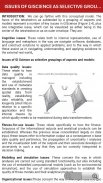
8. GIS 科学问题作为方面的选择性分组
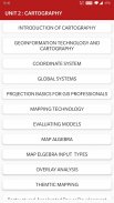
9. 制图学介绍
10. 地理信息技术和制图
11. 坐标系
12. 全球系统
13. GIS 专业人士的投影基础
14. 地图比例
15. 地图投影
16. 几何变换
17. 矢量和栅格数据
18. GIS的空间现象
19. 空间数据功能
20. 数据收集技术
21. 遥感
22. 实地调查
23. 环境模型的作用和性质
24. 环境建模的背景
25. 模型开发总结
26. 应用模型
27. 滑坡建模
28. 建模地形
29. 模型类型
30. 建模方法
31. 地理动力学的表示和计算
32. 时间建模
33. 时态 GIS
34. 数据库概念
35. 数据库设计
36. 数据输入技术
37. 数据编码
38. 全球定位系统(GPS)
39. 编码和解码的比较
40. 地图布局
41. 地图布局元素
42. 完成地图和序列
43. 测序技术
44. 测绘技术
45. 评估模型
46. 地图代数
47. 地图ELGEBRA输入类型
48. 叠加分析
49. 矢量和栅格叠加
50. TARAIN 建模
51. 空间插值
52. 转会功能
53. GIS 和人工神经网络
54. 网络
55. GIS 和网络分析
56. GIS的水资源应用
57. 水文建模
58. 地理信息系统与社会
59. 地理信息系统和运输
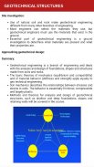
60. 基于 GIS 的岩土特征评估
61. 岩土结构
62. GIS 中的空间数据生成
63. 网络制图
64. 基于网络的设计的重要性
65. 环境影响分析
66. 地图服务
67. 全民教育监测系统的建立和发展
68. 公用事业管理中的 GIS
69. 专题制图
70. 重组加速电力发展改革规划
71. 公用事业管理中的 GIS
72. 专题制图
73. 重组加速电力发展改革规划
74. 摄影测量
75. 移动测绘
由于字数限制,未列出所有主题。
特征 :
*章节明智的完整主题
* 丰富的 UI 布局
* 舒适的阅读模式
* 重要的考试题目
* 非常简单的用户界面
*涵盖大部分主题
* 一键获取相关全书
* 移动优化内容
*移动优化图像
每个主题都配有图表、方程式和其他形式的图形表示,以便更好地学习和快速理解。
这个应用程序将有助于快速参考。使用这个应用程序可以在几个小时内完成所有概念的修改。
请不要给我们较低的评级,而是将您的疑问、问题邮寄给我们,并给我们有价值的评级和建议,以便我们在以后的更新中考虑它。我们很乐意为您解决这些问题。
Geographic Information System - APK信息
APK版本: 11.0程序包: engg.hub.geoinformatics.systemGeographic Information System的最新版本
其他版本


同类应用
 4.484.274.36


